India’s homegrown satellite navigation system NavIC has suffered a major setback after one of its key satellites stopped functioning for navigation services. The satellite IRNSS-1F, which had been part of the system for nearly a decade, lost its final operational atomic clock, raising concerns about the reliability of the network that supports positioning, navigation, and timing services across the country.
The development could temporarily impact the accuracy and coverage of India’s indigenous alternative to GPS.
Atomic Clock Failure Ends Navigation Role
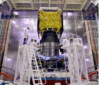
The Indian Space Research Organisation (ISRO) confirmed that IRNSS-1F, which was launched in March 2016, had completed its planned mission life on March 10, 2026. Just a few days later, on March 13, the satellite’s onboard atomic clock — a crucial component for navigation accuracy — stopped functioning.
Atomic clocks are essential for satellite navigation systems because they allow satellites to transmit extremely precise timing signals. These signals enable receivers on Earth to calculate their exact location.
According to ISRO, while the satellite will remain in orbit, it can no longer contribute to navigation services due to the clock failure. However, it will still be used for one-way broadcast messaging services, which support certain public and safety-related applications.
Only Three Satellites Now Fully Operational
With the loss of IRNSS-1F’s navigation capability, the number of satellites currently capable of delivering full Positioning, Navigation and Timing (PNT) services has dropped significantly.
Reports indicate that only three satellites — IRNSS-1B, IRNSS-1L and NVS-01 — are currently operational for navigation services.
This poses a challenge because at least four satellites are typically required to ensure continuous and reliable navigation coverage across India and surrounding regions.
The reduced number of active satellites could affect the performance of location services that rely on NavIC signals.
A System Built for Strategic Independence
NavIC, short for Navigation with Indian Constellation, was developed to give India an independent satellite navigation capability. The initiative gained urgency after India reportedly faced restricted access to accurate GPS data during the 1999 Kargil conflict, which highlighted the risks of relying on foreign systems for critical military operations.
In response, the government launched the Indian Regional Navigation Satellite System (IRNSS) programme, which later became known as NavIC.
Unlike global navigation networks such as the United States’ GPS, China’s BeiDou, Europe’s Galileo, and Russia’s GLONASS, NavIC focuses primarily on the Indian subcontinent and surrounding regions up to about 1,500 kilometres beyond India’s borders.
Challenges in the NavIC Satellite Fleet
Since 2013, ISRO has launched 11 satellites as part of the nearly ₹2,250-crore NavIC programme. However, several of them have faced operational challenges.
Earlier satellites experienced issues due to faulty imported atomic clocks, while some later missions encountered orbital complications.
According to information shared in Parliament last year, only four satellites were fully operational for navigation services, while others were being used in limited roles such as messaging or experimental applications.
In addition, two satellites were unable to reach their intended orbit and another was decommissioned after completing its service life.
Impact on National Infrastructure
NavIC plays a growing role in India’s infrastructure and technology ecosystem. The system is used for transport tracking, disaster alerts, maritime navigation, and strategic defence applications.
The government has also been integrating NavIC into railway systems. Nearly 8,700 trains in India have already been equipped with NavIC-based tracking, with plans to expand the system to track around 12,000 trains in real time.
Any disruption in satellite availability could therefore affect multiple sectors that rely on precise location services.
Final Words
While the failure of IRNSS-1F represents a temporary setback for India’s navigation ambitions, NavIC remains a key strategic project aimed at reducing reliance on foreign satellite systems.
The development also highlights the importance of expanding and upgrading the satellite constellation to maintain reliable coverage.
According to reports by The Indian Express, ISRO is expected to continue strengthening the NavIC network through future satellite launches and improved onboard technologies.